#TBT: UNC Campus, Then & Now
Think campus looks different after all the summer construction? It’s nothing compared to the changes since 1942.
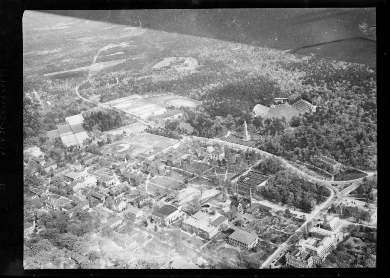
We wanted a more direct comparison, so we used Knight Lab’s Juxtapose tool to make this slider:
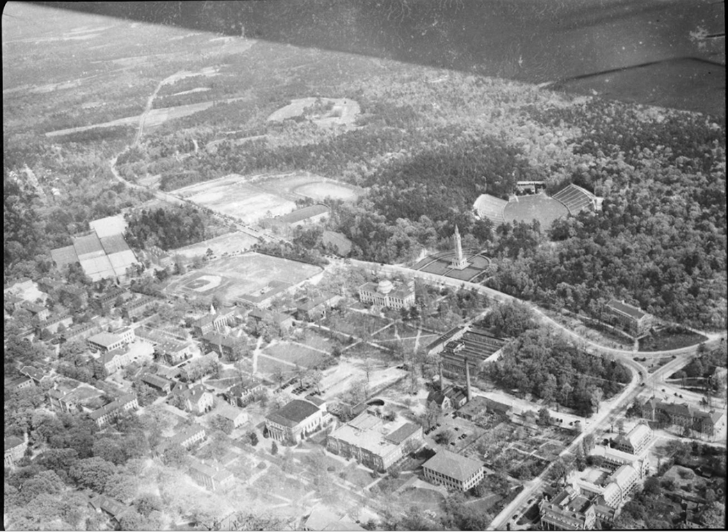
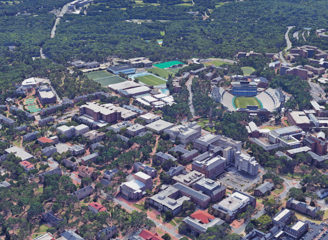
Our favorite buildings (Carroll Hall and most of the libraries, naturally) hadn’t been built yet. Had yours?
Sources
Google earth V 9.1.39.1. [UNC campus], 35° 54′ 47″ N 79°, 03′ 34″ W, Eye alt 588 m. SIO, NOAA, U.S. Navy, NGA, GEBCO. Retrieved from https://earth.google.com/web/@35.90962794,-79.0484972,148.56411385a,1159.43280009d,35y,111.46861517h,67.75728218t,0r [August 11, 2017].
UNC aerial view, in the Hugh Morton Photographs and Films #P0081, copyright 1942, North Carolina Collection, University of North Carolina at Chapel Hill Library. Retrieved from http://dc.lib.unc.edu/cdm/singleitem/collection/morton_highlights/id/4979
